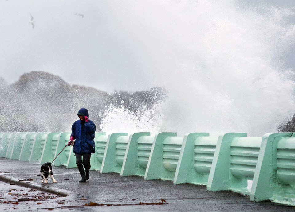
Be prepared for not one but three powerful storms the rest of the week, beginning with rain and wind hitting the region late Wednesday.
A special weather statement to warn people in Greater Victoria has been issued about the three events, with the second slated for Thursday afternoon and the third for Saturday, said Environment Canada meteorologist Armel Castellan.
Updated statements will likely be issued through the week at weather.gc.ca/warnings.
The storms will affect much of the B.C. coast and could bring overall rainfall totals of 400 millimetres or more for parts of western Vancouver Island and other sites, although the Victoria area rain total will be lower and possibly approach 50 mm by Friday, Castellan said.
Winds could exceed 80 kilometres per hour in many areas, including Victoria.
Castellan said the first storm will peter out over the course of Thursday morning before the second in the three-storm sequence kicks in after “a little bit of respite.” The second storm will stay around into Friday before another break from storm activity, then more rain and wind will emerge from the remnants of Typhoon Songda. The typhoon has been active along the coast of Asia and will be making its way to North America.
“It will be a Saturday-into-Sunday event,” Castellan said. “It remains a very big enigma in terms of how bad or how it’s going to manifest itself.”
Such “post-typhoon-like” storms are hard to predict, he said, but the one coming here could be “historic” in its cumulative effects and total rainfall.
As always, B.C. Hydro is aware of the looming conditions and is prepared to deal with concerns as they arise, said spokesman Ted Olynyk.
The corporation has its own meteorologist, he said. “We monitor the weather quite closely for our grid and for our generation facilities.”
Different steps can be taken prior to a weather system arriving, Olynyk said.
“Do we pre-deploy? When and where do we send staff home early, so that way they can be on rest time and be available to deal with the storm when it comes in.”
Castellan said the coming storms could damage trees, as was the case in the storm that hit Greater Victoria last week. He said the large amount of leaves still on many trees can catch the wind and increase potential problems.
“The leaves act like a sail in the trees, so a lesser wind can take a tree down.”
With the trio of storms approaching, the B.C. River Forecast Centre is monitoring the Courtenay and Port Alberni regions for flooding issues, Castellan said.
“That’s where the rivers have potential to crest.”
Rain could dominate the weather for much of next week, he said.


