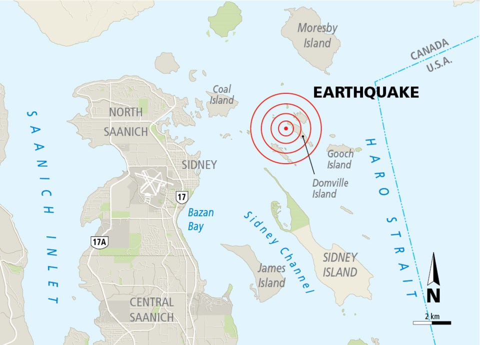
Residents in Sidney and parts of Saanich received a friendly reminder that they live in an earthquake zone when a 2.4-magnitude earthquake was recorded approximately five kilometres east-northeast of Sidney on Wednesday.
The quake, which hit at 12:58 p.m., was picked up by all of the 22 seismograph stations in the region that make up the Canadian National Seismograph Network.
With a magnitude of 2.4, the earthquake is at the threshold where a person would feel some shaking, said Dr. John Cassidy, earthquake seismologist with the Geological Survey of Canada, part of the Earth Sciences Sector of Natural Resources Canada.
“I was sitting on my chair in my home office in Cordova Bay when the quake hit and I didn’t feel a thing,” he said.
Reports from the public to his office ranged from “few seconds of shaking” to “I thought a truck hit the house”.
He said that another reason for the low numbers of reports would be that the epicentre was located between 20 to 21 kilometres deep.
He said that the area where Wednesday’s quake took place is a known active area that is “no stranger” to seismologists, with smaller quakes “happening all the time.”
There have been a few larger ones, too: A 5.4-magnitude quake in the same area shook residents of Pender Island out of their beds early on May 16, 1976. The strongest reported quake hit Jan. 11, 1909, and measured 6.0.
While Wednesday’s event not out of the ordinary, Cassidy said its data will still help seismologists better understand future earthquakes.
Cassidy has all of the scientific instruments Natural Resources Canada possesses at his disposal — but he also has a personal seismograph.
Known as a Rasberry Shake, the simple and inexpensive plug-and-play instrument is used for local monitoring. Citizen scientists have formed a world-wide network to share data and connect with each other.
“It’s incredible how quickly information spreads today,” Cassidy said. He said that there are approximately 10 to 15 instruments in the area.
Other networks monitoring seismic activity in the area include the Web-enabled Awareness Research Network (WARN) project, which uses land and underwater sensors to warn of tsunamis.
The Ministry of Transportation and Infrastructure has its own monitoring network as well, but its instruments are set up to only monitor larger quakes, when there is a potential threat to infrastructures, such as bridges or tunnels.


