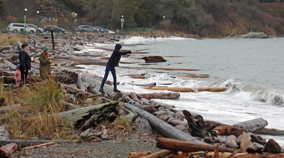
Flood watches and high streamflow advisories remained posted across Vancouver Island as the peak of a so-called king tide passed on Tuesday.
The big tide combined with heavy rain and snowmelt had raised the risk of flooding after pre-Christmas snowstorms.
Flood watches remain in place for west, central, east and south Vancouver Island as river levels continue to rise, bringing fears of flooding in adjacent areas. Heavy rain drenched the regions on Sunday and Monday, speeding snowmelt and causing additional runoff.
A special weather statement on the risk of coastal flooding in low-lying areas on East Vancouver Island ended Tuesday afternoon, but water gauges on the Chemainus River showed a steady increase in water volume Tuesday, the municipality of North Cowichan said, and an evacuation alert remained in place for some properties.
By 5 p.m., river levels were nearing levels that could impact roads, the municipality said, noting that rain was expected to fall until midnight, with another king tide — exceptionally high seasonal tides — forecast for Wednesday morning.
On northern Vancouver Island, where rivers are rising but no major flooding is expected, the River Forecast Centre is maintaining a high streamflow advisory.
The centre said officials were also keeping a close eye on the situation in northwest Washington state, where a flood watch was in effect as the Nooksack River threatened to top its banks.
High water on that river was linked to last November's devastating floods in the Fraser Valley and the centre said there may be a "small chance of a minor overflow" into the Sumas River drainage on the B.C. side of the border.
High tides and high winds led to the cancellation of several ferry sailings on Tuesday. Trips between Swartz Bay and Tsawwassen were cancelled in the morning due to the weather, and sailings on some other routes were delayed due to tidal conditions. The Quadra Island ferry was docked and sailings delayed while crew investigated whether its propeller had been damaged by a log strike.
High winds were expected to continue over Greater Victoria and exposed coastal sections of west Vancouver Island on Tuesday evening. A Pacific frontal system over the south coast was expected to move inland and bring strong westerly winds of 70 kilometres an hour gusting up to 100 km/h.
On the mainland, the City of Vancouver had warned of elevated flood risk as king tides were due early Tuesday at the same time as strong winds were forecast to cause a significant storm surge.
"Low-lying areas … will be at an elevated flood risk and may experience overland flooding," the city said in a statement.
The city had closed part of the Stanley Park seawall as a precaution.
But no major damage was reported, the city said in a statement on Twitter Tuesday.
It posted photos taken at the peak of the tide, showing flooded grassland and roads near several beaches around English Bay, but no major damage.
Environment Canada said the tide pushed water levels at Point Atkinson in West Vancouver to a height of 5.70 metres, breaking the previous record of 5.61 metres set in 1982.
Water levels were expected to fall and conditions were forecast to improve through Tuesday evening, the weather office said on its website.
It was maintaining a rainfall warning for Howe Sound and Metro Vancouver, advising of localized flooding, water pooling on roads and the potential for debris flows. Flood watches and high streamflow advisories issued Monday by the River Forecast Centre also remained in effect.
A landslide 23 kilometres west of Sechelt on Highway 101 closed that road. There were no reports of injuries and the District of Sechelt said on social media that the situation was being assessed.
Elsewhere, Environment Canada was maintaining winter storm warnings or special weather statements for parts of the southern and southeastern Interior as 25 to 30 centimetres of snow was forecast in the Kootenay and Boundary areas before changing to rain or freezing rain later in the day.
A travel advisory was posted urging drivers to stay off Highway 3 east of Osoyoos. The route remained open, although Drive B.C., the province's online travel advisory system, warned of the "high probability" of closures on short notice.
>>> To comment on this article, write a letter to the editor: [email protected]


