A team of scientists mapping the ocean floor off British Columbia have discovered a colossal seamount rivalling Mount Baker.
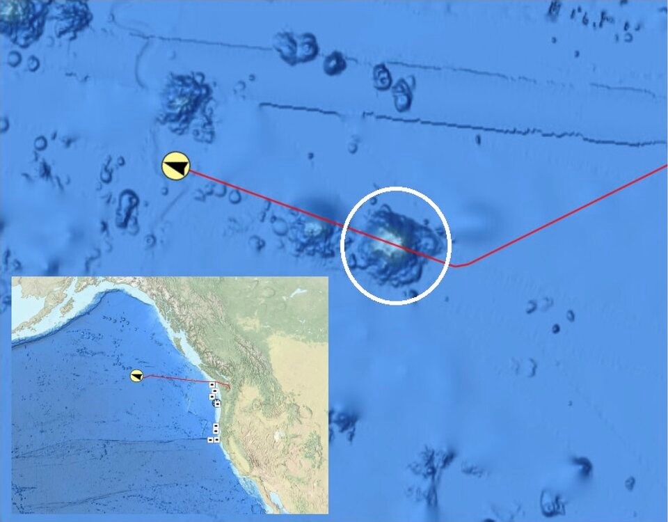
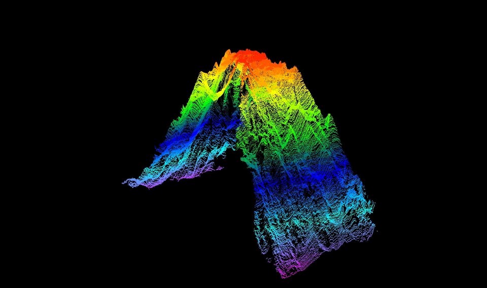
Scientists aboard the U.S. research vessel Okeanos Explorer discovered the underwater mountain as they sailed 645 kilometres off Vancouver Island. When they beamed sonar into the deep, the topographic image that came back showed a seamount climbing at least 3,105 metres from the bottom of the ocean.
The find, a third higher than previous estimates, re-writes previous nautical charts. The underwater mountain rises from a base sitting at 4,000 metres below the surface to its peak 895 metres below sea level. Measured top to bottom, it's roughly a thousand metres higher than the peak of Whistler Mountain.
"High-resolution mapping is immensely valuable to scientists," Sam Cuellar, the expedition's coordinator, said in an email. "It allows us to see the 'big picture' of what underlies 70 per cent of our planet."
The Okeanos Explorer is at sea as part of the U.S. National Oceanic and Atmospheric Administration's (NOAA) Aleutians Deepwater Mapping project, a mission to map unexplored regions of seabed off Alaska. The expedition is exploring over a million square miles of sea floor using sonar.
Cuellar said they mapped the seamount in transit from Seattle, Wash., to the Gulf of Alaska where they plan to carry out their survey. Previous collected bathymetric scans of the deep had only captured the slopes of the underwater mountain, he said.
It's not clear what kind of life exists on the seamount, but others are known to act as a "hot spot" of biodiversity. Home to everything from corals and fish to sponges and other creatures, the raised features feed the surrounding water with nutrients, attracting a vast array of larger creatures such as sharks, whales, squid and octopus.
Cuellar said the mapping project is part of a wider push to trace the deep ocean and provide a “critical baseline” to understand the region’s little explored deep-ocean environment. Humans have so far only mapped 23.4 per cent of the ocean floor at high resolution, according to the Seabed 2030 initiative. Adding to that total will help scientists better understand marine habitats so they can be protected.
Data from the mission — which can be tracked on multiple livestreams — is meant to provide a deeper understanding of deep-sea geology and how such features are formed. Detailed imagery of the deep sea also allows scientists to identify potential hazards like volcanic activity or earthquake-prone fault lines, added Cuellar.
The NOAA expedition also plans to use underwater robotic submarines to locate a Second World War-era B-25 bomber, which disappeared with its nine crew members in 1944.