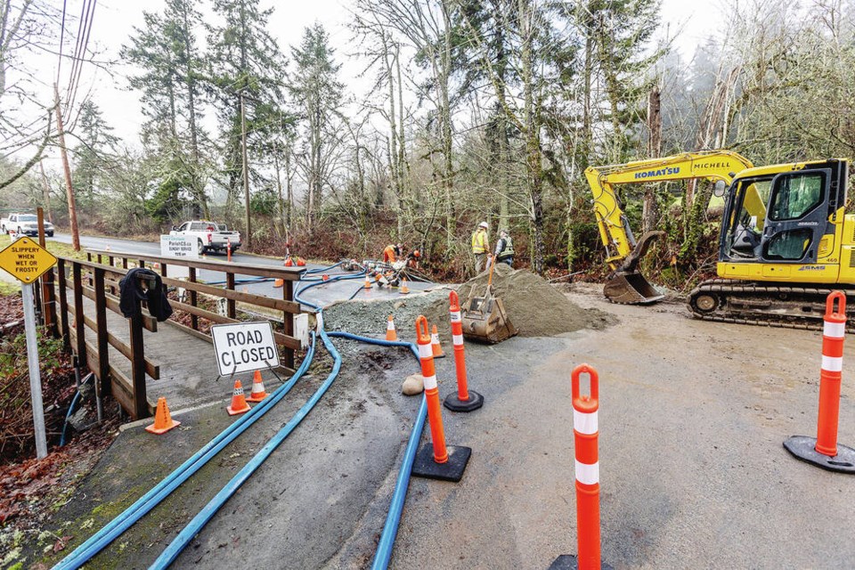
Mount Newton Cross Road at Mount Stephen Road was closed by a washout on Monday and is expected to stay closed for most of the week after a culvert failed during heavy rain.
Elsewhere on the Island, Cowichan Bay Road remained closed due to flooding and Allenby Road near the Cowichan River also remained closed after a mudslide.
More rain is in the forecast.
On Monday, Environment Canada issued a special weather statement calling for heavy rain for much of the Island, with more to come on Wednesday.
“We get a bit of a break and then the next pulse comes in on Wednesday,” said Environment Canada meteorologist Lisa Erven. “Over the last five days or so we’ve basically had a series of storms.”
Cowichan Tribes and the Tseshaht First Nation are keeping a close watch on local conditions, but neither was reporting significant flooding issues with rivers that have caused problems in the past.
The Cowichan River has stabilized and the level has actually been going down, a Cowichan Tribes spokesperson said.
He said one family living next to the river was evacuated Saturday night but was able to return home Monday morning.
“Otherwise it’s looking pretty good right now,” he said. “There’s still some room in the river.”
A weather alert posted on the Cowichan Tribes web page said that increased snow melt due to higher-than-usual temperatures could add to the flow in local waterways.
“There is an increased risk of flooding, pooling water and landslide activity,” said the alert, which urged caution when driving and walking after dark.
Cowichan Tribes and the neighbouring Halalt First Nation had especially serious flooding in 2020, when dozens of people had to evacuate their homes by boat.
The Tseshaht First Nation next to Port Alberni, where flooding of the Somass River occasionally leads to evacuations, is prepared but hasn’t had any problems so far, said emergency-program co-ordinator Kaitlin Minvielle.
“We’ve got sandbags and we’re ready,” she said. “The river’s still at a decent level, so we’re just crossing our fingers and hoping that we avoid this one.”
She said there are 12 to 18 homes along the river that tend to flood when the river is high.
People in the capital region can expect showers through much of the week.
On the mainland, the River Forecast Centre issued a flood warning for the Squamish River and tributaries including the Cheakamus River.
A bulletin Monday afternoon said water levels in the Squamish River were rising. With additional rainfall expected in the river’s headwaters, water levels might continue rising into today, it said.
Tributaries including the Cheakamus River were “expected to exceed bank-full flow,” the bulletin said.
— With a file from The Canadian Press
>>> To comment on this article, write a letter to the editor: [email protected]


