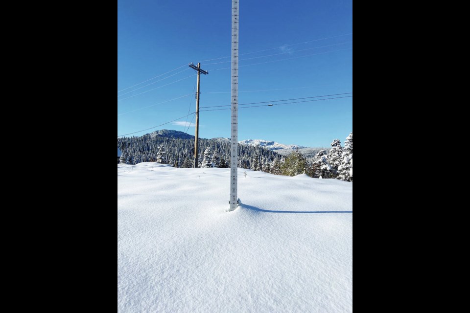
Mount Washington has received its first snowfall of the season, with more than 40 centimetres blanketing the resort.
Kayla Stockton, the resort’s marketing manager, said she left work on Monday night in a T-shirt under sunny skies. On her drive up the mountain to the resort the next morning, however, “it was definitely full on winter,” and snow continued to fall throughout the day Tuesday.
“We were completely brushing off our cars, digging them out to leave work Tuesday,” Stockton said.
The resort hasn’t started officially recording the depth of snowfalls, but unofficial measurements show upwards of 40 centimetres came down in a 24-hour period, Stockton said.
“It’s definitely exciting. The buzz around the resort is much more uplifting. It gets everyone really excited to get the skis and snowboards on.”
It’s not unusual for Mount Washington to get snow in late October, but the amount this time is more than normal, she said.
The first snow fell on Mount Washington last year around the same time, but it was just a light dusting. In early November, the resort was covered with about a metre of snow, but it melted within a week, Stockton said.
While temperatures are expected to warm up, Stockton noted that there is more precipitation in the forecast. “So we can only hope that the snow sticks around and it builds up a nice base for the ski season.”
Mount Washington’s planned opening date is Dec. 8. It’s unlikely the ski resort will open earlier even if there’s a ton of snow, because staff training is based on the opening date, Stockton said.
Temperatures on the Island were about four to six degrees below seasonal on Tuesday, hovering around zero for communities at sea level and colder at higher elevations, said Derek Lee, a meteorologist with Environment and Climate Change Canada.
Snow fell in Comox, Shawnigan Lake and Chemainus, he said.
A low-pressure system has moved on and days will become sunnier and remain cool, just a few degrees below seasonal, into next week, Lee said. Most of the Island can expect temperatures of around 11 C during the day, and 4 C overnight.
After three consecutive years of a La Niña effect that brought colder-than-normal temperatures, the coast is expected to be hit by El Niño, bringing warmer-than-average weather this winter, Lee said, although it’s unclear what that will mean for the ski season.
Warmer air usually comes from the Pacific, which means it’s also moist. So a warmer winter doesn’t mean less precipitation, but it could mean less snow on the mountains, he said.
“But it doesn’t mean there’s going to be no snow at all. It’s really hard to tell at this point,” Lee said.


