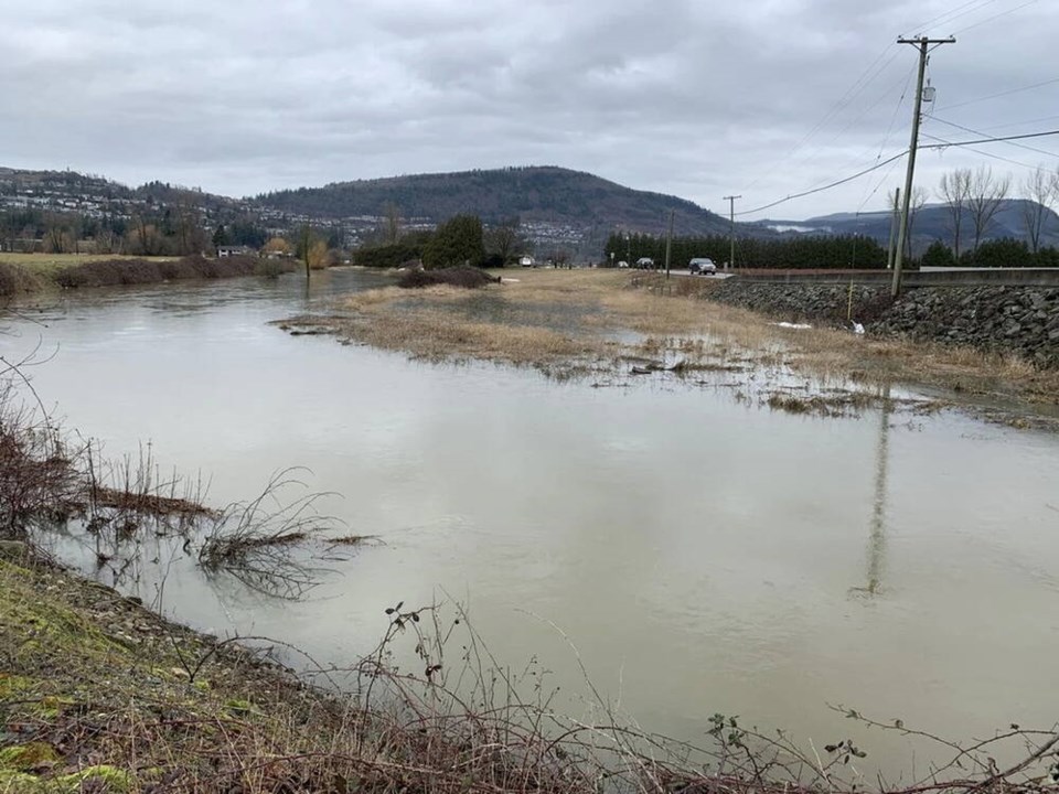
The River Forecast Centre has issued a flood watch for parts of B.C.’s south coast, including Vancouver Island, the North Shore mountains, the northern Fraser Valley, and the Sea-to-Sky region, as a series of atmospheric rivers is expected to bring heavy rain starting Friday.
A high stream flow warning is also in effect for parts of the eastern Fraser Valley, including tributaries around Abbotsford and Hope, as well as Pemberton and the Fraser Canyon.
The bulletin, released Thursday afternoon, states that a series of “potent” storms will hit the coast, with the first storm expected Friday, and another Saturday and Sunday, with a third on Monday.
The strongest atmospheric river will make landfall Monday, with the heaviest rainfall — possibly 200 to 300 millimetres from Saturday to Wednesday — forecasted over West Vancouver and the Coast Mountains. There is the potential for some areas to see up to 400 millimetres.
Other areas, such as Howe Sound, the Sunshine Coast, parts of Vancouver Island and the Fraser Valley, could get 70 to 250 millimetres of rain, while double-digit temperatures cause mid-elevation mountain snow to melt.
Peak river levels are expected in most areas Sunday to Tuesday with a “high likelihood” for moderate flood conditions, meaning two-year to 10-year flows in areas with the heaviest rainfall, and a chance of some 20-year flows.
A flood watch is issued when river levels are rising and will approach or possibly exceed “bankfull” — where a river is at the top of its bank. A flood warning, the next step, is issued when rivers exceed that level and flooding is expected.
While the storms are still a few days out, meaning there is uncertainty over the amount of rain and locations of the heaviest rain, several factors “raise the level of concern,” said Environment Canada meteorologist Alyssa Charbonneau.
The freezing level is supposed to rise to about 2,500 metres, meaning there will likely be some snow melt at lower and mid-elevations. It’s already soggy in the Lower Mainland after last week’s big snowstorm. Snow melt and soil saturation both play a role in flood risk.
“There are a few more ingredients (compared to other atmospheric rivers this winter) that raise the level of concern,” said Charbonneau.
Weather watchers first posted about the impending atmospheric river on social media earlier this week.
Environment Canada has been tracking the storm — or storms — as well, but can’t predict their severity with certainty more than a day or two out.
At first, the anticipated storms looked like one event, said Charbonneau. Now, it looks like two back-to-back storms, or a series, with breaks between.
Atmospheric rivers are very narrow bands of water vapour, so slight changes in their track over the course of days, or hours, makes a big difference in where, and how much, precipitation falls.
While storms can definitely cause trouble on the B.C. coast, the area typically gets more rain, and the impacts of a big storm on the coastal mountains will be different than if the same system hits with full force inland.
In November 2021, a series of atmospheric rivers battered B.C., resulting in deadly flooding that caused billions of dollars in damage and washed away bridges and roads. About 14,000 people were displaced.
The event was unique not only for the amount of precipitation and snowmelt that it caused, but also for its impacts inland. Over 48 hours, West Vancouver got almost 160 millimetres of rain, while Abbotsford got almost 170 millimetres and the Coquihalla summit got 230 millimetres.
Charbonneau said it is probably not a good idea to check the forecast Friday and assume it will stay the same through the weekend. Environment Canada and the B.C. River Forecast Centre will provide updates as the situation unfolds.
“These systems can really shift,” she said, “so it’s something we need to be watching.”
In a statement, the Ministry of Emergency Management and Climate Readiness said it is hosting “coordination calls” with local governments and First Nations in the southwest and Vancouver Island coastal regions about the upcoming rainfall event.
People are asked to take precautions to ensure personal safety, including developing a household plan, putting together emergency kits, connecting with neighbours and learning about the local government emergency response plan for their area.
Travellers should monitor road conditions.
The River Forecast Centre will continue to monitor weather patterns and river conditions through the storms and will post information about flood hazards, which could include issuing broadcast and wireless intrusive emergency alerts on behalf of communities to warn people about imminent threats.
>>> To comment on this article, write a letter to the editor: [email protected]