A Campbell River-area First Nation made a bold proclamation Monday that it wants a seat at the table when it comes to stewardship of a massive area of its traditional territory that it said was taken “by a stroke of a pen” nearly a century ago.
The Mamalilikulla First Nation declared a 10,416-hectare parcel in Knight Inlet an Indigenous Protected and Conserved Area (IPCA), saying the nation has inherent responsibilities for the land, sea and natural resources within its territory and that the rights and title to the area were never ceded to provincial or federal governments.
“We have a starving mother grizzly bear and her cub with no salmon,” said Mamalilikulla First Nation Chief John Powell. “In the mid-1990s, there were 150,000 fish in the watershed [rivers] on this land … this year there are only 26 salmon. This means one bear could not survive on this.
“We are not saying you can’t fish here or you can’t log there … but we are saying we have to start doing something in a responsible way.”
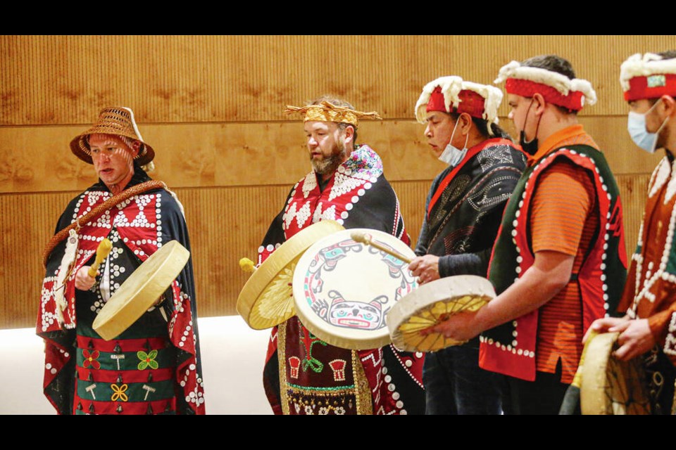
About two dozen Mamalilikulla members celebrated the signing of the IPCA at the Royal British Columbia Museum on Monday, calling it a “historic day” for the nation. Drums and dancers punctuated the ceremonial signing by Powell, councillors, former chiefs and elders.
“The area has great significance to our people, and we are taking the initiative to restore our traditional governance approach,” said Powell.
He said the Mamalilikulla people intend to take a significant role in protecting, conserving and sustainably managing the IPCA by applying their laws, governance and knowledge systems under a “co-governance” arrangement with the federal and provincial governments.
Powell said the Mamalilikulla’s systems are based on the ancient concept of Aweenak’ola, reflecting balance, sustainable use and harvests, as well as ongoing planning and stewardship, monitoring and “adaptive management.”
He said meetings with the province regarding the IPCA had been set up for this week, but flooding across southern B.C. has postponed the initial discussions.
Chief Robert Joseph, Ambassador for Reconciliation Canada and a member of the National Assembly of First Nations Elders Council, said the IPCA is a significant, historic breakthrough for Indigenous peoples. “What the Mamalilikulla people have done is serve notice that they want local decision-making that [has been] given to other forces of harvesting or other forces of greed.
“Now the voices of the Mamalilikulla must be heard.”
The Gwaxdlala/Nalaxdlala area, also known as Lull Bay/Hoeya Sound, is in Knight Inlet on B.C.’s central coast on the mainland, just across from the area between Port McNeill and Campbell River on the Island.
The 10,416-hectare area includes three original Mamalilikulla settlements for the Lull/Hoeya area. It includes reserve proposals that were originally rejected by the 1914-18 McKenna-McBride Commission for lands along the shore of Knight Inlet, and along each side of the Lull River and estuary.
The Mamalilikulla Nation continues to take part in legal discussions associated with the rejection of its reserve proposals at that time. “With the stroke of a pen, it was the end of of our ownership of the area,” said Powell.
The home territory of the Mamalilikulla and Qwe-Qwa’Sot’Em groups of Kwakwaka’wakw was in the maze of islands and inlets of Knight Inlet, mainly on Village Island, where their principal village Memkumlis is still located.
The band has three reserves: Apsagayu Indian Reserve No. 1A, Compton Island Indian Reserve No. 6, and Mamalilikulla Indian Reserve No. 1. The First Nation is a member of the Kwakiutl District Council.
As of August, the Nation had a total of 441 registered members.
Powell said the IPCA represents a “constructive challenge” to federal and provincial leaders to honour and put into action the articles of the United Nations Declaration of the Rights of Indigenous Peoples.
Those UN articles include respecting Indigenous peoples’ right to ownership, control over use, conservation and protection, and setting of development priorities for its traditional lands, territories and resources.
Powell said the marine component of the IPCA comprises about 2,100 hectares and includes the Hoeya Sill, a diverse ecological area that includes rare shallow sponges and corals not seen anywhere on the B.C. coast and susceptible to bottom contact by boats and motors. The Lull and Hoeya estuaries are critical salmon-rearing areas and key for grizzly bear foraging.
The watersheds comprise 8,300 hectares of old-growth and second-growth hemlock and cedar and are open to logging. They’re considered essential to salmon, mammals and birds such as the marbled murrelet.
Powell said the steeply sloping watersheds require careful management of human activities such as logging and roadbuilding.
Several provincial Crown tenures exist in the IPCA area, including those for log handling, heli-logging drops, recreation, trapping and fisheries.
The Mamalilikulla First Nation has developed management plans for both watershed and marine portions of the IPCA, outlining specific management zones and acceptable uses, and identifying sensitive sites for fish and animals and cultural sites such as petroglyphs, middens, archaeological areas and sacred trees.
Plans include an immediate focus on landscape restoration zones and a halt on forest harvesting for five years while the Mamalilikulla develop a long-term management strategy.


