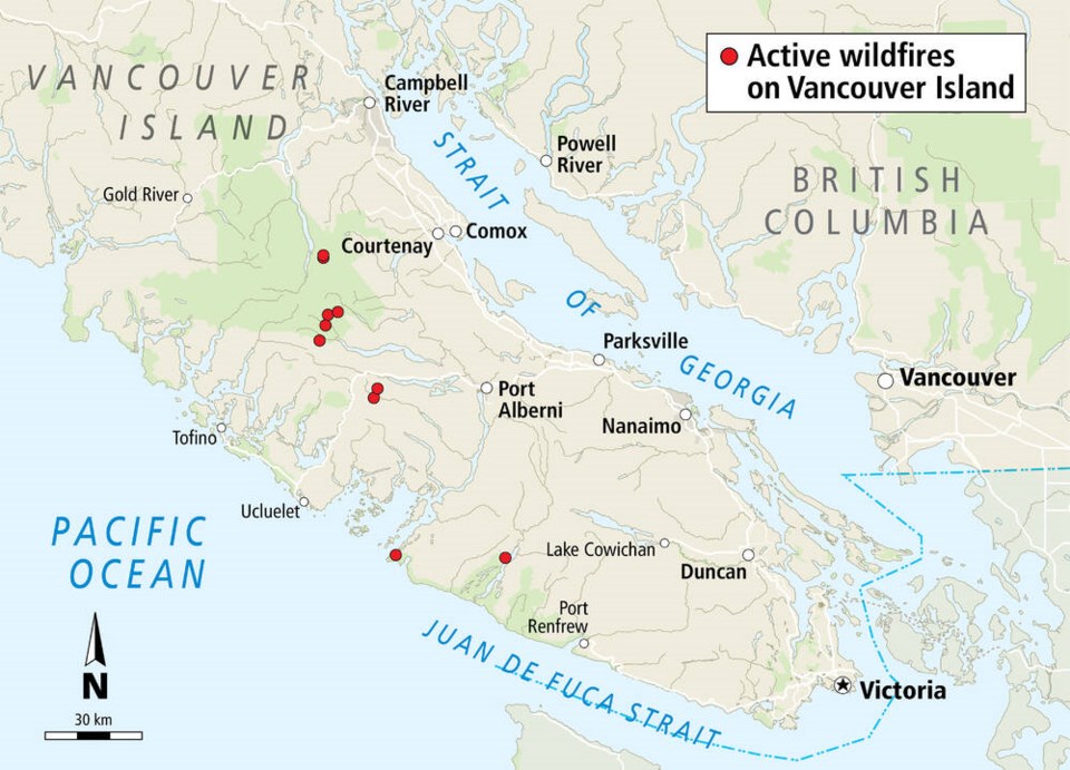
A lightning storm that rolled over western and central Vancouver Island sparked at least 10 wildfires on Wednesday.
All of the ignitions are considered “spot fires” of less than one hectare in size.
B.C. Wildfire Service crews are using helicopters to watch for spreading, said Nadia Linning, spokeswoman for the service, said Wednesday afternoon.
“We had anticipated the lightning strikes and increased our prep level with additional resources on standby,” Linning said.
The fires are at Ralph River, Shepherd Creek, south of Homasum Lake, Della Falls, west of McBride Lake, north of Nahmint Lake, Nahmint River, Barkley Sound area, Nitinat Lake and northwest of Great Central Lake.
Lightning activity was expected to continue Wednesday night into today.
“There is the possibility of more lightning strikes and possible fires, and we are watching for holdover fires,” said Linning, noting a lightning strike can smoulder for several days before becoming an active fire.
The Island has had 25 fires reported this year, but all have been small. Conditions have been extremely dry and campfire bans were put in place last Thursday.
There have been 573 wildfires in the province so far this year, with most of the major fires in the Interior and southeastern regions.
There are currently 59 active fires in B.C. — 24 per cent considered out of control and 73 per cent caused by lightning.
Crews were making progress on several wildfires Wednesday, including a blaze near Lytton that broke out nearly a month ago and destroyed several properties.
But B.C. Wildfire Service information officer Mikhail Elsay told a news conference that crews were still having a difficult fight with the 67-square-kilometre fire southwest of Penticton in the Okanagan.
“While we have been making good progress, this fire is still uncontained, and out of control at this time, especially on the western flanks,” he said.
Elsay said new drone technology is being used to scan the fire’s edges to ensure flames have been put out. The drone was operated overnight and helped crews understand what hot spots should be targeted, he said.
“This thermal scan allows us to really nail down the final spots, especially the tricky, rocky, deep burning root systems. These drones are very sensitive, they can pick up even very small amounts of heat. So we’ll be able to really confirm the work that we’re doing out there.”
The area where crews have made progress means that residents in about four dozen homes will be allowed to return.
However, more than 400 other homes, including the entire community of Olalla, remain under evacuation order.
Another 900 properties in the area are under an evacuation alert, which means residents have to be ready to leave on short notice.
Erick Thompson, information officer for the Regional District of Okanagan-Similkameen, said one uninhabited outbuilding was destroyed in the fire.
Highway 3A, which cuts through the valley where crews have been trying to control the wildfire, remains closed.
Elsay said firefighters are watching the weather, which shows a lightning storm for the Penticton area beginning Wednesday afternoon. This could bring with it “erratic winds” and some rain, he added.
The cause of the fire remains under investigation.
>>> To comment on this article, write a letter to the editor: [email protected]


