Residents in coastal and southern British Columbia were mopping up Tuesday after an atmospheric river brought torrential rain and wind, while disrupting travel and utility services.
Kennedy Lake, north of Ucluelet, received 132 millimetres of rain over a 24-hour period — the most in the province — while the total reached 102 millimetres on the Sunshine Coast and 97 millimetres in Mission in the Fraser Valley.
The downpour caused a minor rock slide on Highway 4, the main route connecting the Island’s east and west coasts, at the Cameron Lake site, where a wildfire on the bluffs above the road led to a highway closure during the summer.
Fallen debris was caught by a barrier and fencing that was put in place during the highway closure, which kept lanes clear and vehicles moving safely, said a spokesperson for the Ministry of Transportation and Infrastructure.
Despite the deluge, Ucluelet Mayor Marilyn McEwen said the west coast of the Island was spared any flooding during the rainstorm.
“The earth here is so used to having a lot of rain, it’s just like water off a duck’s back,” she said.
Elsewhere on the Island, a landslide closed a portion of Sooke River Road Tuesday morning, while Burnside Road West was also closed after a fallen tree brought down power lines.
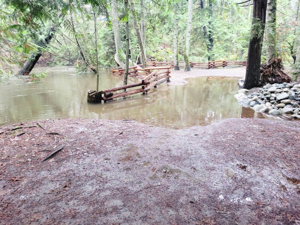
Sooke River Road, which provides access to the Sooke Potholes, remained closed for much of the day — affecting about six properties located beyond the closure site.
Sooke spokesperson Christina Moog said the road had a single lane opened about 4 p.m. for local traffic only, with crews continuing to work in hopes of a full opening by 7 p.m.
West Shore RCMP responded to the Burnside Road West incident about 9:15 a.m.
The Island remained under a high streamflow advisory Tuesday, which means river levels were expected to rise rapidly, but no major flooding was expected, although minor flooding in low-lying areas was possible.
The province’s River Forecast Centre said in an advisory that river flows were likely to peak late Tuesday into Wednesday, and were expected to be highest on the west coast of the Island.
Fast-flowing rivers pose an increased risk to safety, it said, and people near rivers are advised to be cautious and aware that conditions may change quickly.
Ian Bruce, senior biologist at Peninsula Streams Society, said water levels in south Island streams and creeks were high after Monday’s rain, but it doesn’t appear there has been any damage to salmon-spawning beds. The society works to restore salmon stocks through stream restoration across the capital region.
Water in streams and creeks is still cloudy, so the society isn’t yet able to check for damage, but Bruce said he’s optimistic spawning beds are intact.
“It’s been such low numbers coming back to spawn in the creeks around here, so that’s a good thing. What few fish did get to spawn, we can’t afford to lose those eggs,” he said.
The system also brought strong winds to the coast, with gusts reaching 150 kilometres an hour at Sartine Island near the northern tip of Vancouver Island, and 115 km/h at Sandspit on Haida Gwaii.
On the mainland, Metro Vancouver, the south coast and Lower Fraser regions remained under a flood watch Tuesday, meaning rivers and streams were expected to rise as a wave of warmer air melted snow and increased the runoff.
High streamflow advisories were also in place for the the West and East Kootenay regions, and several rivers in the southern Interior.
Pooling water on roadways slowed traffic in southwestern B.C., with Highway 99 in Richmond, Highway 7B in Port Coquitlam and Highway 1 in Surrey all seeing disruptions from flooding on Tuesday.
But a stretch of Highway 1 in the Fraser Canyon south of Lytton reopened after geotechnical experts recommended a precautionary closure into Tuesday in an area of a wildfire last summer.
Environment Canada is also warning of continued winter storm conditions along Highway 1 from Eagle Pass to Rogers Pass and in Yoho National Park in southeastern B.C.
— With files from The Canadian Press and Roxanne Egan-Elliott, Times Colonist


