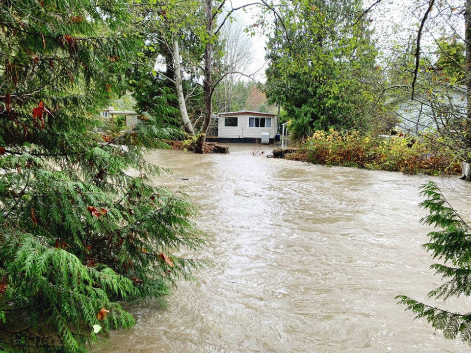
Vancouver Island areas such as Parksville-Qualicum and the Cowichan Valley that were hit with flooding last weekend should brace for similar weather later this week.
A series of storms are forecast for B.C.’s south coast starting Thursday, following heavy rains last week that destroyed highways and displaced thousands in the province. About 100 people were evacuated in the Parksville-Qualicum Beach area near Englishman River because of flooding, and about 30 in the Cowichan Valley were put in hotels.
Areas near the Englishman, Cowichan, Chemainus and Koksilah rivers, which experienced high water levels last week, are being watched closely, said Dave Campbell, head of the province’s River Forecast Centre.
With several storms expected in close succession, there’s concern about the cumulative impacts, he said. “So it really is a heads up at this point of time. We’re certainly concerned about ongoing active conditions really starting on Thursday, and carrying into next week.”
The River Forecast Centre had no warnings for Vancouver Island on Monday, but Campbell said that’s likely to change Tuesday.
High streamflow advisories — meaning river levels are rising or expected to rise rapidly but no major flooding is expected — could be issued for parts of Vancouver Island Tuesday. Minor flooding in low-lying areas is possible during high streamflow advisories.
“The way the storm looks, for the first one I wouldn’t anticipate that it would go beyond a high streamflow advisory for the first cycle,” Campbell said. “If things were to be bumped up to flood watch, at this point the way the weather looks, that might be more kind of on the weekend.”
A flood watch means river levels are rising and could overflow their banks, leading to flooding of adjacent areas.
Campbell said it’s difficult to say at this point whether the coming storms would bring more rain than last week.
The Alberni Valley near Sproat Lake could also be affected by continued rainfall, he said.
The forecast isn’t showing huge rainfall for the Malahat, but Campbell urged drivers to check forecasts through Environment Canada and DriveBC before travelling later this week.
Communities on Vancouver Island’s west coast are likely to see more rain than those on the east coast, said Armel Castellan, a warning preparedness meteorologist for Environment and Climate Change Canada. Areas like Zeballos could see up to 200 millimetres of rain, he said during a briefing on the storms forecast.
That amount of rainfall isn’t unheard of for the area, but with soil already saturated and short intervals between storms, communities could be more vulnerable to coming rain, Castellan said.
“We’re on a streak and that pattern is very consistent into the coming days and certainly coming week if not longer,” he said.
Tofino Mayor Dan Law said although last week was wet in Tofino, the rain brought no significant problems.
“Tofino can handle and has handled, you know, 230 millimetres of rain in a weekend without any issue,” he said. “So Tofino can handle a very, very large amount of rain much differently than, say the Interior or the Lower Mainland, for sure.”


