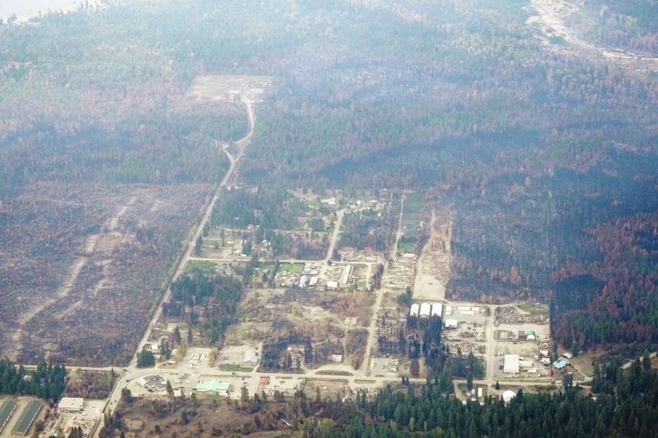
Near-record drought conditions across the province created conditions for B.C.’s worst wildfire season on record, but winter rains may not bring replenishing relief.
The soils in drought-shrivelled landscapes become “hydrophobic” — so dried and packed down that rainfall runs off before soaking in — which increases the risk of flash flooding in atmospheric-river storm events.
“It depends on when they come,” said University of B.C. hydrologist John Richardson. “If we get sort of gentle rains for a few weeks, that will reduce some of the risks, but there’s nothing that can really guard us against a storm like we had in November 2021.”
Climate change stacks the deck in favour of the likelihood for atmospheric-river events to occur, said Richardson, a professor of forest and conservation science at UBC’s faculty of forestry.
“There’s a lot more temperature accumulating in places in oceans, which produce these more intense storms,” Richardson said. “And it’s a storm’s intensity, not the total amount of rainfall, that will be most important.”
In the short term, Environment Canada’s forecasts don’t point to any change in drought conditions in the coming weeks.
It was dry right across the province in June, July and August.
The Victoria airport, for example, recorded 37.5 mm of rain in those three months; 72.3 mm is the 1981-2010 “normal” amount.
“We’ve seen season over season drought,” said warning-preparedness meteorologist Armel Castellan at Environment Canada.
A sliver of B.C. in the far northwest on the Highway 37 corridor north of Hazelton to Dease Lake saw just more than normal precipitation over the last 14 months, Castellan said.
“Almost the entire rest of the province is at a [precipitation] deficit,” Castellan said. “Some places as low as 30 to 45 per cent of seasonal (normal amounts).”
>See FLOODING, A2
> B.C. forms task force for rapid response on climate emergencies, A6
Richardson said wildfires compound the risk of drought because fire burns off plant growth in forest understories and destroys the root systems of trees that would normally help absorb rainfall to be released more slowly into ground water tables.
“There are at least three elements in the recipe” for flash floods, Richardson said. Intense rain is the first, then compromised soils and steep slopes.
So “the lack of slope stability, because basically the roots are burned away and there’s not much holding the soils together, we could see increased risk (of) more erosion,” Richardson said.
And the stems of burned trees and surface ash will be added to debris flows from flash flooding when it does happen, which creates the potential for more serious damage to the ecosystems of rivers and streams.
Simon Fraser University hydrologist Jesse Hahm said the amount of forests burned this year spreads the problem around.
“When (water is) flowing over the surface, it’s not filtered and is picking up that ash,” said Hahm, an assistant professor in SFU’s geography department. “That’s a cause of concern for aquatic ecosystems, but it’s also a concern for surface-water extraction for municipal or agricultural use.”
The province is working on detailed flood-hazard mapping in B.C., according to staff from the Ministry of Emergency Management and Climate Readiness.
No one was made available for an interview, but in an unattributed email statement sent in response to media questions, ministry staff said the province is also developing a provincial flood strategy, which will help reduce flood risks.
“The province understands that people and communities are concerned about flood risk,” the statement reads, and it has a stockpile of flood-control materials, including 4.2 million sandbags and 35.6 km of temporary flood-control Tiger Dams on standby.
Although seasonal precipitation is a certainty, both as rain in coastal regions and snow in Interior regions, when that will start is more difficult to predict, Castellan said.
“September, October, November, independent of El Niño, are the worst (for) seasonal forecasts for the entire year,” Castellan said.
Castellan said that in the seasonal transition from warm to cold makes it difficult to estimate whether conditions will be wetter or drier, warmer or colder. Into winter, however, the warmer ocean conditions characteristic of El Niño are expected to deliver warmer, drier weather.
>>> To comment on this article, write a letter to the editor: [email protected]


