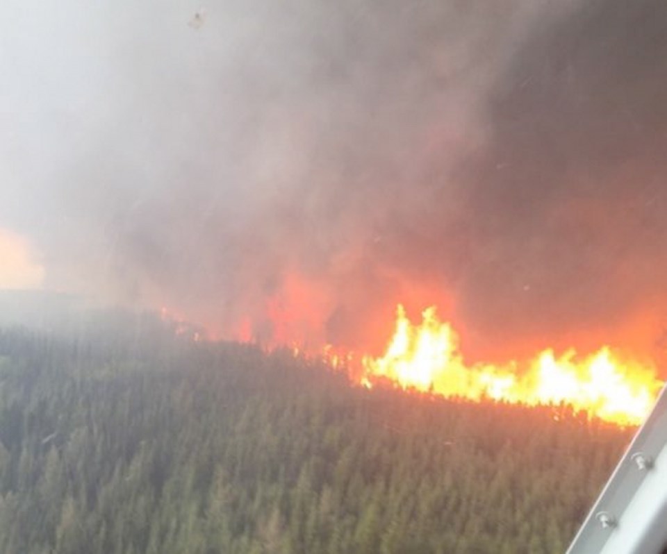
Here's the latest information from B.C. Wildfire Service on the major wildfires burning in the region:
Click here for a map of wildfires in the province.
SIPHON CREEK
Location: Siphon Creek Road; four kilometres south of the Doig River First Nations community
Discovered: Monday, April 18, 2016
Size: 24,000 hectares (estimated)
Status: Active, 0% contained
Evacuation Order and Alert is in effect. Details and maps available via the Peace River Regional District.
Resources: 81 firefighters, 12 helicopters, 12 heavy equipment. Due to wind gusts yesterday and throughout the evening, the fire continued to move north and northwest. The majority of the growth was in Alberta. Priorities for the crews continue to be public safety. Today crews will continue to build containment lines and burn out where possible.
More information: A 9-person Incident Management Team is assigned to this incident.
BEATTON AIRPORT ROAD
Location: 45 kilometres northwest of Fort St. John
Discovered: Monday, April 18, 2016
Size: 12,000 hectares (estimated)
Status: Active
Evacuation Order and Alert is in effect. Details and maps available via the Peace River Regional District.
Resources: 129 firefighters, 10 helicopters, 16 heavy equipment, 10-person incident management team
More information: Crews will be burning-off areas along southwest corner of the fire to remove fuels. This area is adjacent to the Alaska Highway, which may cause visibility issues resulting in some temporary road closures. Residents in the area should expect to see increased smoke between 10 a.m. and 2 p.m.
East Division: will continue to use heavy equipment to build and solidify control lines.
West Division: crews continue to mop-up and patrol areas.
A mix of sun and cloud today with a potential for showers this evening, Saturday May 7, 2016.BCWS forecasters are calling for variable winds southwest/northwest. Winds will be 20-30 km/hr potentially gusting to 60 km/h. This will increase fire behaviour.
CARTER ROAD
Location: 10 kilometres northwest of Hudson's Hope
Discovered: Tuesday, April 19, 2016
Size: 450 hectares (estimated)
Status: Active, 50% contained
Resources: 80 firefighters, 4 helicopters, 9 heavy equipment
More information: There was no significant growth on this incident on Friday, May 6. Crews are working on mop-up and patrol at the base of the fire and developing a plan for the rest of the wildfire. An IMT team has been assigned to this incident.
DOIG RIVER
Location: 2 kilometres north of the Doig River First Nations community
Discovered: Friday, April 29, 2016
Size: 300 hectares (estimated)
Status: Active, 90% contained
Resources: 56 firefighters, 1 helicopters, 6 heavy equipment
More information: Today crews will continue to build containment lines, mop up and conduct burn out operations where possible. A 9-person Incident Management Team is assigned to this fire.
HUDSON'S HOPE
Location: 4 kilometres northwest of Hudson's Hope
Discovered: Monday, April 18, 2016
Size: 300 hectares (estimated)
Status: 100% contained, in mop-up stage
Resources: 12 firefighters, 2 heavy equipment. Firefighters are being assisted by heavy equipment.
More information: Crews are working on the ongoing mop-up of the wildfire.
CLEARVIEW
Location: South of Cecil Lake road; 30 kilometres east of Fort St. John
Discovered: Saturday, April 30, 2016
Size: 48 hectares (estimated)
Status: 100% contained
Resources: 16 firefighters. These resources are working on this incident and the Voight Creek fire.
More information: Crews are working on ongoing mop-up to reinforcement containment lines.
VOIGHT CREEK
Location: South of Cecil Lake Road; 30 kilometres east of Fort St. John
Discovered: Saturday, April 30, 2016
Size: 31 hectares (estimated)
Status: 100% contained
Resources: 16 firefighters. These resources are working on this incident and the Voight Creek fire.
More information: Crews are working on ongoing mop-up to reinforcement containment lines.


