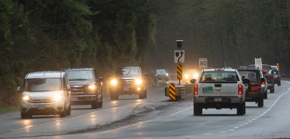
 Malahat highway closures seem to come more often than they used to, and the disruption seems a lot more acute.
So the thought of an emergency detour route, as expressed by Transportation Minister Claire Trevena last week, gets a lot of attention.
But any cost-benefit analysis of the idea will have to wrestle with a tricky proposition that involves spending millions of dollars to solve a problem that crops up intermittently and unpredictably at different spots on the highway.
It’s the only specific item mentioned in the minister’s announcement that she’s launching an all-encompassing south Island transportation strategy that will look at almost every mode of movement and develop a roadmap for future investments.
As noted here Tuesday, the Capital Regional District completed a major project four years ago that sounds like exactly the same thing.
A key part of that plan was a recommendation for a new governance model with a new transportation-service authority and a different funding scheme. That part of the plan didn’t survive the regional political warfare. So if Trevena wants to do more than just rehash work already completed, she should make the call on whether to override the bickering and jam the new authority in place.
Back on the Malahat, there’s a lot of work on the alternative-route option already on the books, as well.
A comprehensive Malahat Corridor Study in 2007 delved into numerous issues associated with that problematic 20-kilometre stretch of mountain highway.
It’s got a lot of the detailed discussion of alternative routes that will be considered once again in the new strategy. The difference is that the latest look will consider them as temporary emergency routes, not permanent options.
Whatever the construction standard, they all have various constraints.
The 2007 study found that reliability, meaning avoidance of collision-related shutdowns, was the primary issue. There was still unused capacity and the Malahat safety record is within standards.
“Although the frequency and severity of crashes gives rise to road-safety concerns, the crash rate is lower than the provincial average for highways of a similar nature.”
It cited statistics from the previous five years (2000-2004) showing an average of 53 crashes a year.
They counted 54 road closures over the five years, averaging nine a year. About 29 of them were for more than an hour.
A later study in 2012 extended the data to 2011 and found 63 closures from 2006 to 2011.
All the ways to solve that problem were addressed, including improvements to the existing route (mostly accomplished now), alternative modes, such as transit, and alternative routes.
It’s the last option that will get renewed attention in the latest study.
Multimillion-dollar upgrades to the Saanich Inlet ferry route were considered, but they would handle only a small fraction of the traffic volume and add substantially to travel times.
Bridging the inlet was examined, as well, but it would cost a billion dollars or more and come with an assortment of ramifications.
More relevant today are the studies of alternative routes west of the existing highway.
There are alternatives now at Shawnigan and Finlayson Arm, but they are problematic and don’t cover much of the route.
All the potential new ones are constrained by difficult terrain, designated parkland, a rail line, out-of-bounds watershed and Indigenous concerns.
The study cited four options.
• Near West — It involves running a new road as long as possible from south of Goldstream Park to Tunnel Hill partway up the Malahat, without crossing the E&N line and minimizing intrusion in the Sooke Hills wilderness reserve.
• The E&N Right of Way — Instead of preserving the abandoned line for future rail service, develop it as a highway around Goldstream to a point farther up the mountain.
• Niagara Main — A similar plan further west of the rail line using an abandoned forestry road, parts of which are now being used as a hiking-biking trail.
• Shawnigan — A new alignment that bypasses Goldstream and the Malahat completely, linking at Mill Bay.
• Far West — A completely new, much-longer route from Sooke to Cobble Hill, with no impact on park or watershed.
Engineers will have a field day re-analyzing those as emergency routes. So will bean-counters, wondering if they’re worth it.


