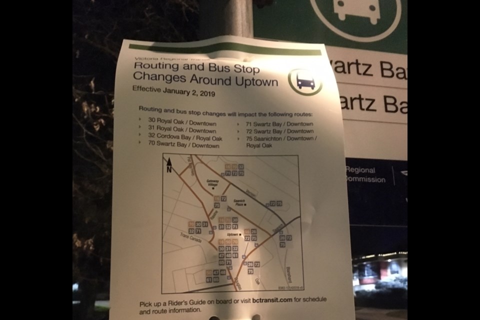
Several Greater Victoria bus routes are getting adjustments because of the new Douglas Street bus lanes.
I suspect a lot of riders will be surprised by the changes, especially those using stops that are being dropped. Notices at those stops are a bit cryptic, announcing general changes without specifically saying that, say, Route 70 will no longer stop here. I asked family members and colleagues who are regular 70 riders and none of them knew about the changes.
The routes affected are:
30/31 Royal Oak/Downtown
32 Royal Oak/Cordova Bay
70/71 Downtown/Swartz Bay
72 Downtown/Swartz Bay
75 Royal Oak/Downtown/Saanichton
The changes came into force on Jan. 2, 2019.
Those routes will no longer go onto Blanshard Street. Instead, they’ll stay on the Douglas Street bus lanes between downtown and the Uptown area. By using the bus lanes, buses should have a better chance of staying on schedule. There’s also a new transit-priority traffic signal at the Douglas and Carey intersection, smoothing the way for buses to get between Douglas Street and the Patricia Bay Highway.
I’m mostly interested in what’s happened with Route 70 because I ride it regularly to get to Swartz Bay ferry terminal. From downtown, it now goes up Douglas and swoops to the west side of Uptown, onto Carey Road, then Raviine Way, then northbound Highway 17.
For me, the most significant change is the dropping of the northbound stop at Vernon Avenue across the street from the Save-on-Foods grocery store. The closest stop on the revised route will be a bit to the north, in front of Saanich Municipal Hall, across the street from Gateway Village shopping centre.
B.C. Transit has details in this PDF document, including maps.
I found the maps to be a little hard to decipher because they do not zoom in on the areas where the changes are being made.
So, because I’m a bus-riding nerd, I’m planning to ride the changed routes to make sure I understand what’s going on. It’s also an excuse for another visit to the Sidney waterfront, and another ferry trip.
My previous postings are here.
My guide to riding public transit between Victoria and Vancouver.


