The Cowichan Tribes First Nation has issued an evacuation order for residents living on two areas of its lands due to flooding. An evacuation order was issued for people living on Wil’seem and Sahilton roads due immediate danger.
People with vehicles are asked to go to Oceanfront Suites, 1681 Cowichan Bay Rd., Cowichan Bay.
People who do not have access to a vehicle for transportation and/or need to be closer to town can instead go to the Best Western Cowichan Valley Inn at 6457 Norcross Rd.
To prevent the spread of COVID- 19, people are urged not to share vehicles between households.
The Cowichan Valley Regional District is helping co-ordinate the evacuation. A representative from the Cowichan Tribes First Nation emergency support services will be on hand for registration upon arrival.
To request transportation or accommodation assistance, call 250-715-3339.
The Cowichan Tribes website and Facebook page will be regularly updated with information.
- - -
Update: The effects of heavy rains on Saturday are still being felt on some roads on south Vancouver Island today.
Cowichan Bay Road between Tzouhalem Road and Highway 1 has been closed in both directions due to flooding near Duncan Sunday afternoon. Drivers can detour via Bench Road.
Flooding was also reported on Highway 14 between Sombrio Beach Trail and Petrel Drive (nine kilometres west of Jordan River). Travel has been reduced to single lane alternating traffic. Flooding has also been reported between Rosemond Creek and Sombrio.
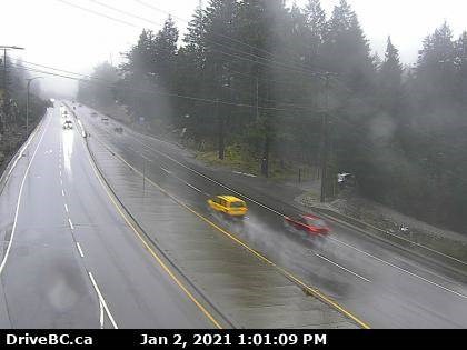
Along with pooling water on the Trans-Canada Highway, Drive B.C. warns drivers they may encounter areas with limited visibility along the route caused by patches of dense fog.
- - -
Heavy sustained rain over the last 48 hours has led to slick roads, a boil-water advisory and an evacuation alert due to quickly-rising river levels on Vancouver Island.
Much of the Island has been socked with rain in the last two days due to a winter weather system passing southern Vancouver Island. Environment Canada issued a rainfall warning warning for east Vancouver Island, from Nanoose Bay to Fanny Bay, on Friday evening.
Cowichan Tribes First Nation issued an evacuation alert for residents living on its reserve lands on Saturday.
The alert warns residents to be prepared to evacuate due to a potential danger to life and health risk from flooding.
The Cowichan Tribes First Nation warn residents may receive little notice of a declared evacuation of their property due to changing conditions.
People with mobility issues are strongly advised to evacuate immediately.
Cowichan Tribes First Nation residents can call 250-715-3339 to report flooding or to find information on transportation and accommodation options.
The alert applies to property located in Quamichan west, Clem Clem, Wil’seem Road, Sahilton Road, Tyup Road, Joe Road, and Green Point or Khenipson Road.
The B.C. River Forecast Centre on Saturday afternoon upgraded a high streamflow advisory to a flood watch warning for eastern Vancouver Island from Nanaimo to Fanny Bay including Englishman River near Parksville, Nanaimo River near Cassidy and both their surrounding tributaries.
Driving conditions along the Trans-Canada Highway were described as “brutal” by some motorists who were on the road on Saturday afternoon.
The volume of water created a mini-waterfall cascading off a rock face along a section of the highway near the Malahat summit, with water flowing over a portion of the roadway.
A number of sections of the highway were under a layer of standing water, causing vehicles to hydroplane.
One motorist said that he has never seen that much water in his 21 years of driving the route daily from Victoria to Duncan.
Most of Vancouver Island from Campbell River to Victoria remains under a high streamflow advisory, with high water levels reported at Goldstream River, Witty’s Lagoon and Bowker Creek.
Renfrew Road in Shawnigan Lake was reportedly under water at the section where the TransCanada trail crosses on Saturday afternoon.
Rivers are forecast to reach their highest flows later Saturday or overnight into Sunday.
High tides Saturday evening may add additional challenges in estuary areas on eastern Vancouver Island.
The Comox Valley Water System issued a boil water notice due to high turbidity levels at both Comox Lake and Puntledge River. The district’s 45,000 residents are asked to boil their water because the high turbidity can interfere with the chlorination process used to disinfect their drinking water. People are advised to stay away from fast-flowing water and to avoid walking along eroding riverbanks.
The rain is forecast to ease on Sunday and return on Monday.