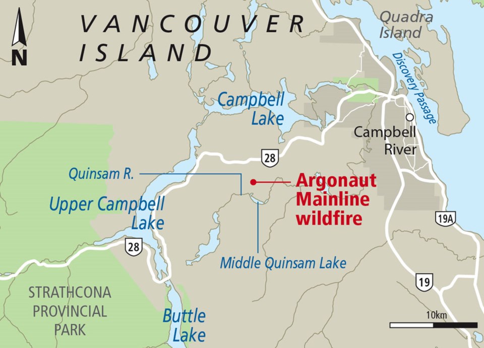
A 33-hectare wildfire burning about 19 kilometres southwest of Campbell River was about 95 per cent contained Friday, said Coastal Fire Centre spokeswoman Jeanne Larsen.
There has been no lightning in the area in recent days, so there is a chance the fire, burning in a slash area, was caused by humans.
“The fire-cause investigator is still on site working on it,” Larsen said.
Last year, the Coastal Fire Centre dealt with 144 wildfires, Larsen said. Of those, 135 were caused by people.
Larsen said that as a result of the fire’s location in the vicinity of the Quinsam Coal Mine, no emergency measures have been necessary.
“We did no evacuations, we did no tactical withdrawals,” she said. “Basically, what we did is we just removed the personnel from the site so our crews could start fire-suppression activities.”
Larsen said the fire started Wednesday.
“We got the first call shortly after 6 o’clock in the evening.”
She said Vancouver Island has had a few other wildfires since the start of spring, while there has been a total of 29 in the Coastal Fire Centre area, which includes a portion of the southeast mainland and Haida Gwaii.
Larsen said two helicopters and two tank trucks were part of the fire response Thursday, but that was down to one helicopter Friday, plus a crew of about 25.
Meanwhile, two fires were burning out of control in B.C.’s southern Interior on Friday.
A fire about 55 kilometres northwest of Kamloops doubled in size overnight Thursday and has burned through 16 square kilometres of bush, said Nicole Bonnett with the B.C. Wildfire Service.
Crews continued to work on the out-of-control blaze and were expecting added help from the air and with heavy machinery.
“It is still putting up quite a bit of smoke so it still will be visible to quite a few communities in the area,” Bonnett said.
The fire is burning on the perimeter of a 2,000-square- kilometre area that was scorched by B.C.’s largest wildfire of 2017. Bonnett said the new fire is distinct from the one that destroyed forests, brush and buildings last summer.
The other out-of-control blaze has scorched about four-square kilometres of timber on the steep side of Anderson Lake, west of Lillooet.
Slightly more than 200 fires have been recorded across the province since the season began on April 1.
The wildfire service website shows the fire risk for most of B.C. is now rated moderate to high, with several parts of the province rated at an extreme risk.
A ban on some open fires was enacted in most of the Coastal Fire Centre last week, but campfires were not affected. The ban applies to the burning of piles less than two metres high and three metres wide, as well as stubble or grass in areas under 2,000 square metres.
Haida Gwaii and a narrow strip in the west and north of Vancouver Island called the “fog zone” are exempt.
Campfires smaller than 50 centimetres high and 50 cm wide are still allowed.
Last year, the Coastal Fire Centre brought in a campfire ban on July 6.