A storm cycle over Vancouver Island means river levels in three Island regions are likely to rise significantly, with a peak reached on Wednesday.
According to a high stream flow advisory from the River Forecast Centre, heavy rains should result in river levels reaching two-year return flows, the similar level reached last week.
A return period is the statistical probability of an event occurring in any year — a two-year return period event has a 50 per cent chance of occurring in any given year.
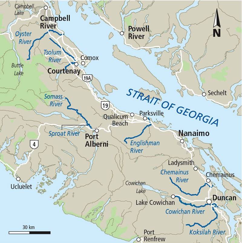
On southern Vancouver Island the advisory covers the Chemainus River, Cowichan River, Koksilah River and surrounding areas. In the central region it includes Sproat River, Somass River and its tributaries and areas around Port Alberni. On the east coast of the Island it covers Englishman River, Tsolum River, Oyster River and its tributaries as well as Campbell River, Comox, Parksville and surrounding areas.
The centre said heavy rainfall is expected through Thursday with as much as 100 to 150 millimetres hitting the Island.
Because of rising temperatures, snowmelt is expected to contribute to river runoff during the storm.
The Somass River is expected to experience the heaviest flow, with a five-year return period level forecast.
High tides and a moderate storm surge are also expected through the week, particularly on Thursday, and may exacerbate river levels at river outlets, according to the centre.


