From the old-growth stands of the West Coast Trail to the sea-swept shoreline of Haida Gwaii, some of British Columbia’s favourite trails will soon be trekkable from home.
Using Google Street View, visitors from around the world will be able to explore more than 1,500 kilometres of trails across the province, thanks to a partnership between Google Maps, Destination B.C. and the Northern B.C. Tourism Association.
It expands Google Street View’s coverage of parks and trails already documented through a partnership with Parks Canada, including Fort Rodd Hill and the Gulf Islands National Park Reserve.
“[Tourists] kind of want to know, how can I prepare for this trip? What could a trip look like? It gives people the opportunity to engage with a place before they leave,” said Maya Lange, vice-president of global marketing for Destination B.C.
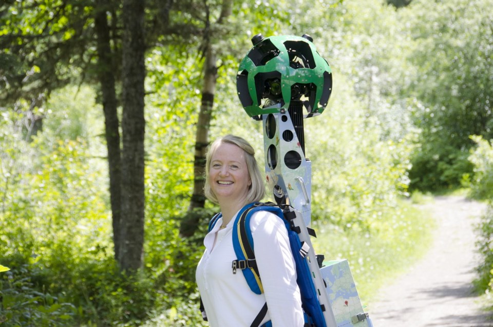
For 100 days between June and September, teams will roam old-growth groves and climb mountains carrying two Google Street View Trekkers — wearable backpacks outfitted with 15 cameras that collect 360-degree panoramic imagery. The Vancouver Island component is set to be recorded in August.
After the images are collected, a Google Maps team in California will stitch the images together. Similar mapping projects have already been completed at the Pyramids of Giza, the Grand Canyon and the Galapagos Islands.
“We’re working with local tourism associations to make sure we’re getting the best places that provide amazing scenery and inspiration to people,” Lange said.
The images are expected to go online in February or March 2017.
Destination B.C. will also build a platform for its own site layering the Google maps with more content, including videos of local personalities talking about the history and culture of an area.
The tourism association has already embraced virtual tourism in the Great Bear Rainforest, allowing users to explore the park and its wildlife online, Lange said.
Eugene Thomlinson, Royal Roads University’s bachelor of arts program head for global tourism management, said one challenge can be spreading awareness of the images.
“You still run into a lot of people who don’t understand that Google Street View has gone off road to the Great Barrier Reef, the Amazon and the Grand Canyon,” Thomlinson said.
Once that barrier is crossed, however, technologies that provide virtual visits tend to have a positive effect on people’s decisions to travel — especially for more risk-averse travellers.
“People want some reassurance about what they’re getting into,” Thomlinson said.
Ray Freeman, associate faculty member for Royal Roads’ school of tourism and hospitality, said virtual tourism is a relatively new and promising field.
“It’s an opportunity to place the potential traveller into the scenery to understand more about what a destination has to offer. I think it’s very exciting,” Freeman said.
Savvy destination marketers can track visits to websites such as Google Maps and target ads at users who explore the trails, he said.
Keeping up with technology is an important strategy for the tourism industry.
“I think as we continue to use mobile technology and smartphones, it will be important for destination marketers to use the tools that we use on a daily basis,” Freeman said.