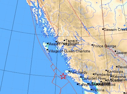
A 4.8-magnitude earthquake has struck off the west coast of Vancouver Island.
The quake was recorded yesterday at 10:05 p.m., 89 kilometres from Port Alice and 166 km southwest of Port Hardy, at a depth of 10 km, according to Earthquakes Canada and the U.S. Geological Survey. The Canadian agency gave the magnitude as 4.4, while the U.S. one said it was 4.8.
There were no reports of damage and none were expected, according to Earthquakes Canada.
As of 11 p.m., the USGS had received reports from two people saying they had felt the temblor — one in Victoria and one in Washington state.


